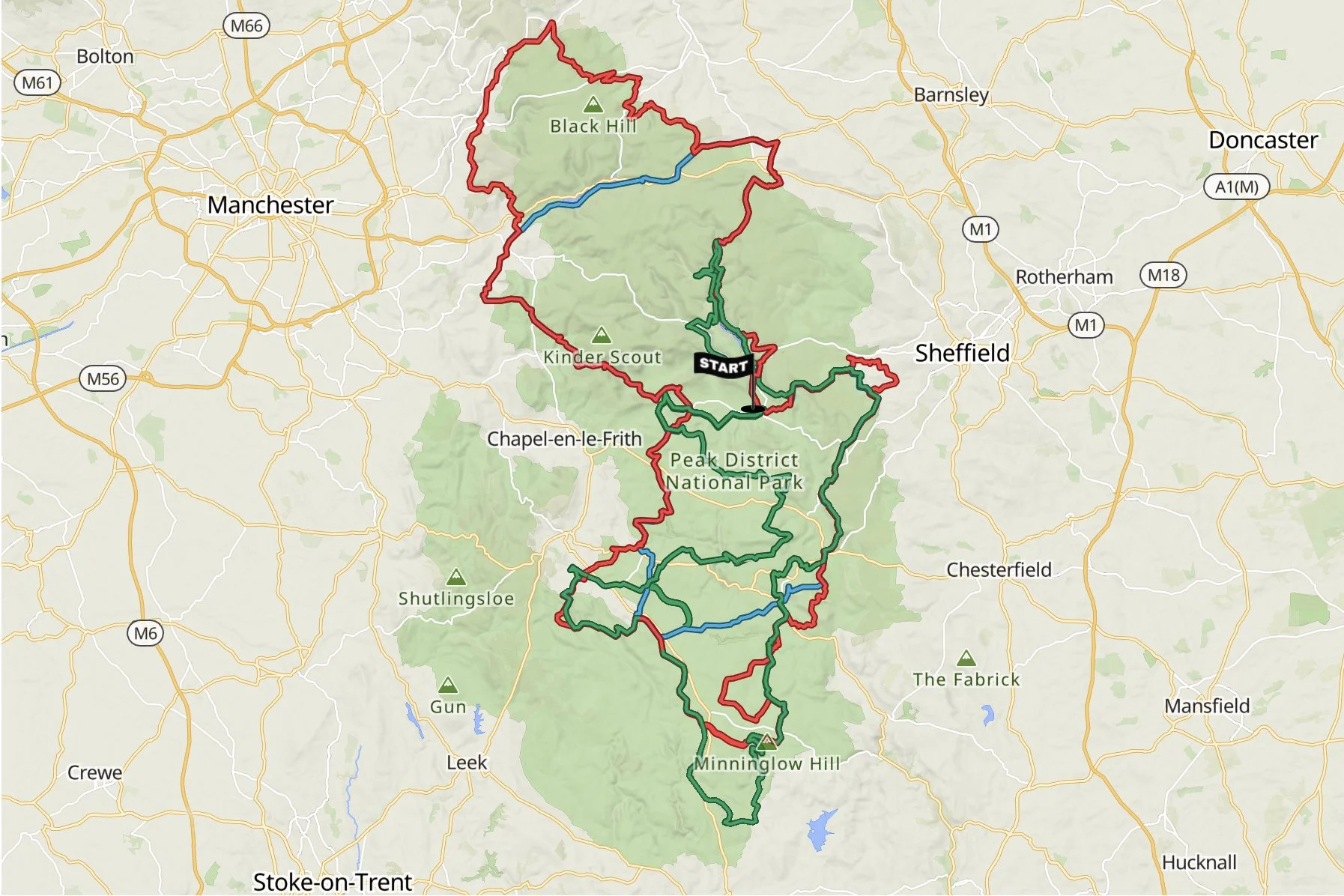
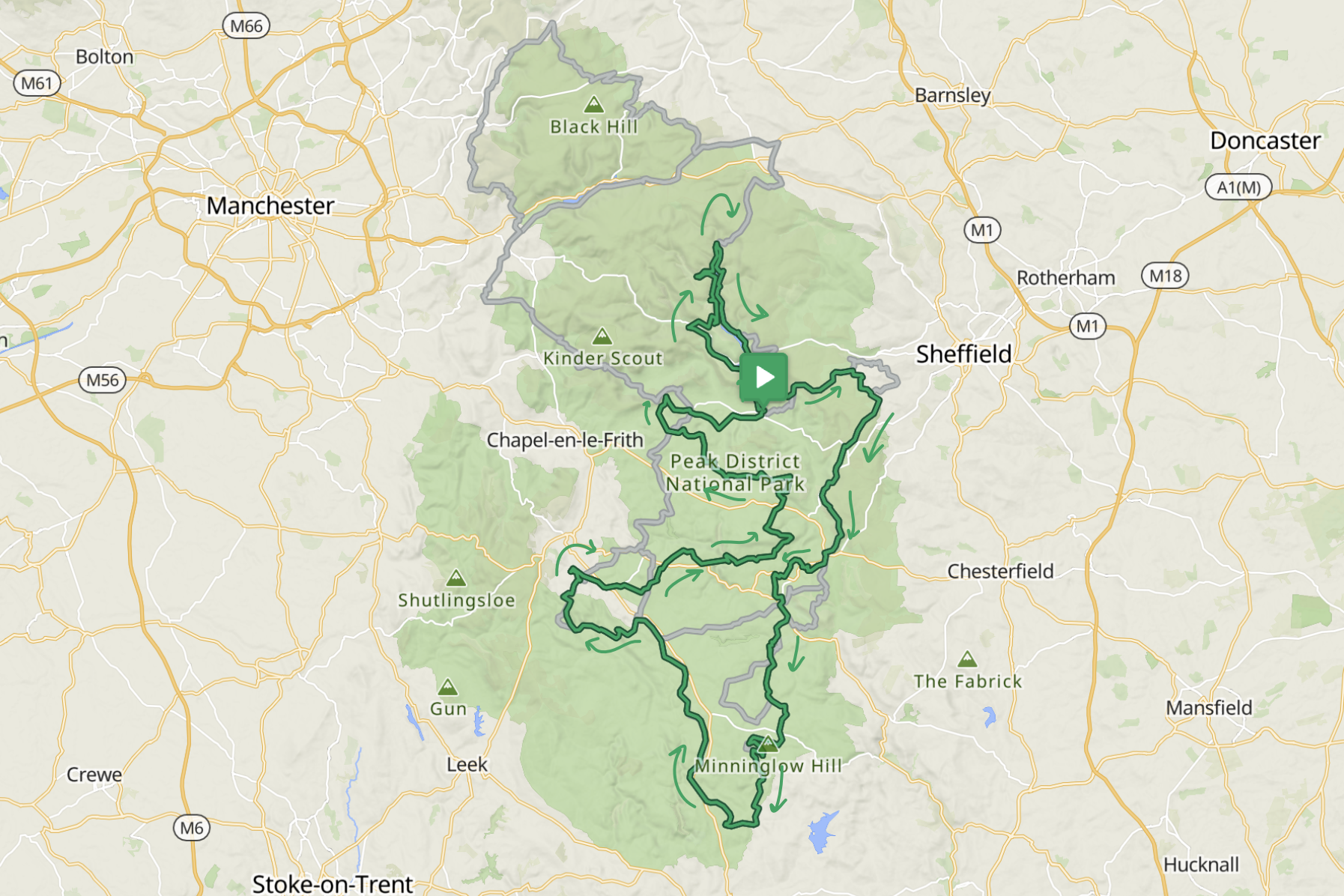
2027 Routes
In 2027 we will continue with the same formula: 3 distances & 3 routes to suit everyone.
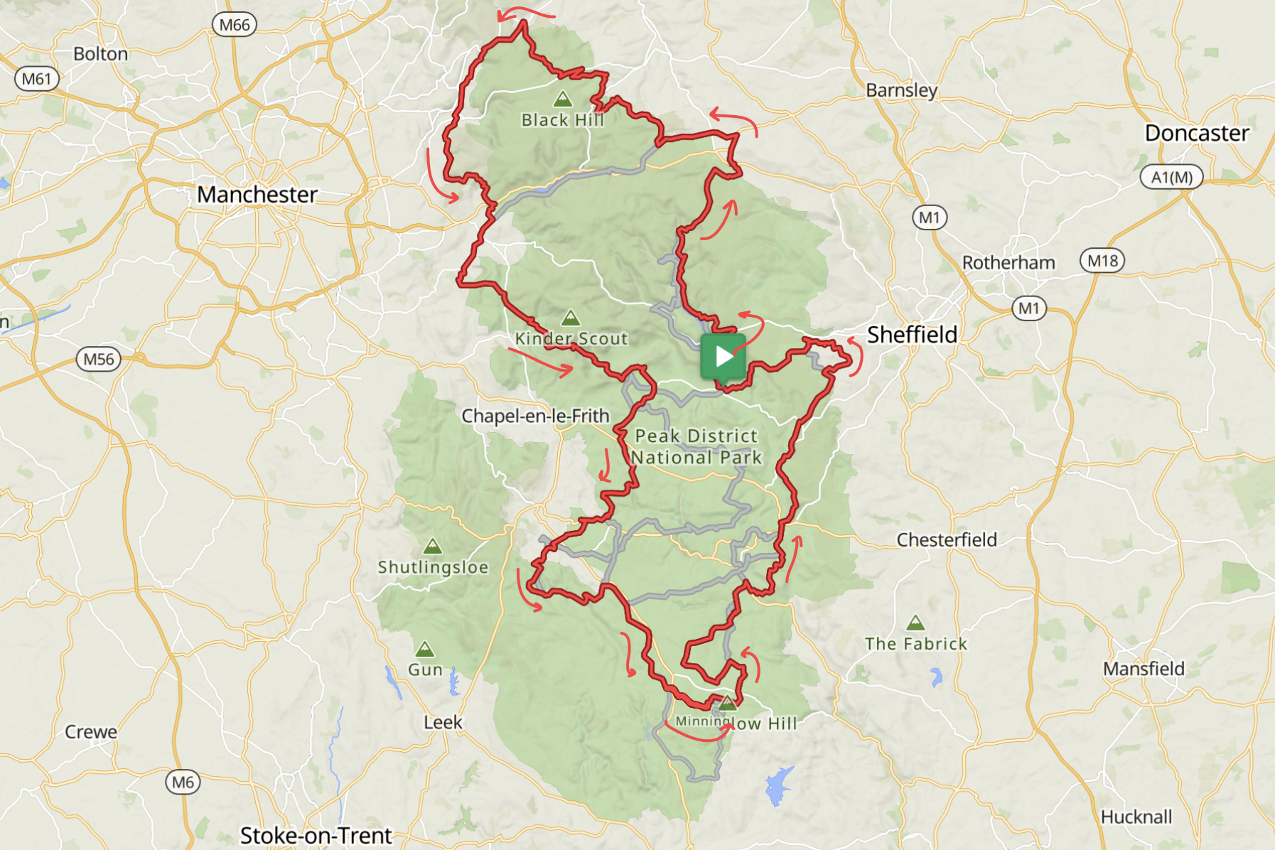
The Divide (red) route spans the Peak District National Park, offering a taste of diverse riding experiences: from smooth roads to thrilling technical mountain biking challenges.
The Millstone (blue) shows the wide spectrum of terrain of the Divide, including some epic trails and quiet repurposed railway lines.
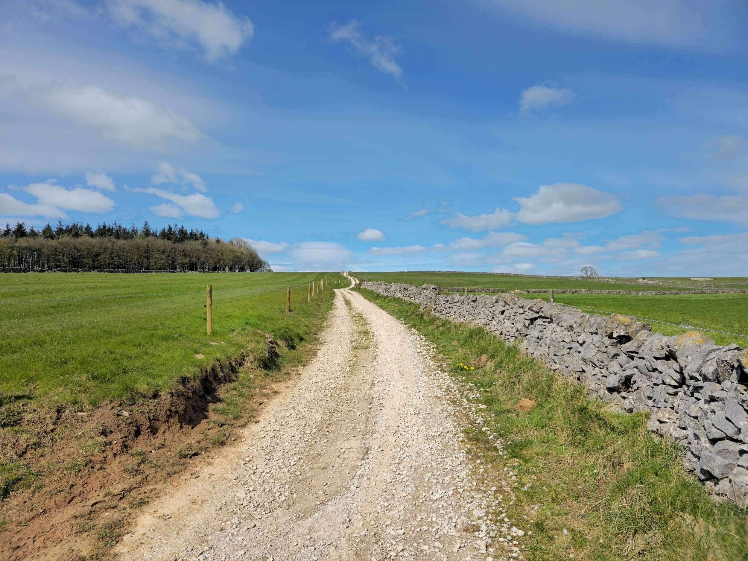
The Peak Gravel (green) route covers the best double-tracks, trails and quiet roads the National Park has to offer.
The routes will be inspired by the 2026 routes, with enough changes to keep them interesting enough for returning riders, while still hitting the highlights of the Peak District.
Event participants will receive the Event Manual, route files complete with POIs, approximately 2 weeks before the event.
Participants will receive access to the RWGPS Premium features for the duration of the event, including turn-by-turn navigation and off-line access to maps.

2026 Routes
After countless explorations through every season and weather, we’re thrilled to present 3 routes that promise and adventure you won’t forget.
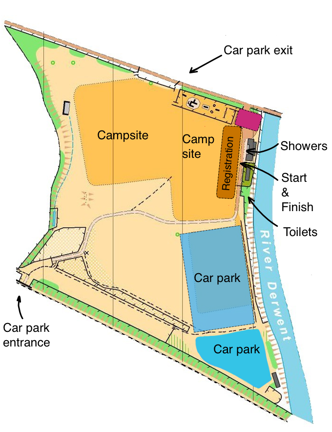
Event Location
The start and finish of the routes will be at the Event HQ, the Bamford with Thornhill Recreation Ground.
Please use the instructions on the event manual when driving to the site, as Google Maps will take you to the wrong entrance.
Nested in the Hope Valley, Bamford is the ideal place to explore the Peak District. For the event we’ll use the Recreation Ground, which has a pavilion building, toilet and shower facilities, ample space for camping and parking. From the event village you can easily reach Lady Bower reservoir where the famous Dam Busters trained. It is a short ride to the lovely peak villages of Hathersage, Hope and Castleton.
The event venue, including parking and camping, will open in the late afternoon on the Friday and close on Sunday at 5pm. Please do not leave your vehicle there if you don’t plan to return in time as we will be locking the Ground when leaving.
The Divide
Approximately 250km & 5500m+ / 155miles & 16000ft+
45% paved, 55% unpaved including technical sections
Starting in the heart of the Peak District, the Divide is a true epic adventure, covering an impressive 250km with over 5,400 meters of climbing. This journey takes you through some of the most stunning and varied terrain in the National Park, passing iconic landmarks and picturesque villages along the way.
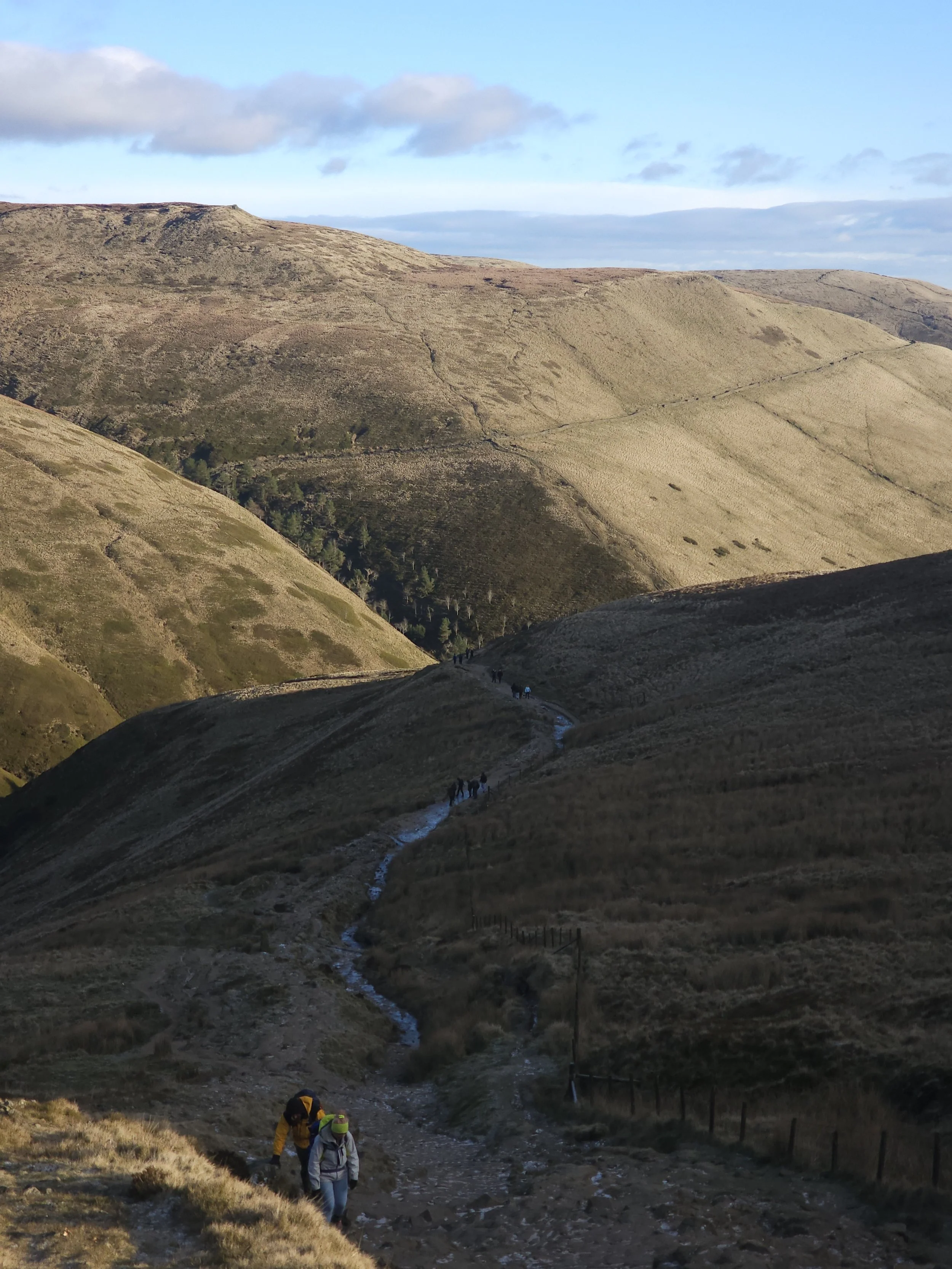
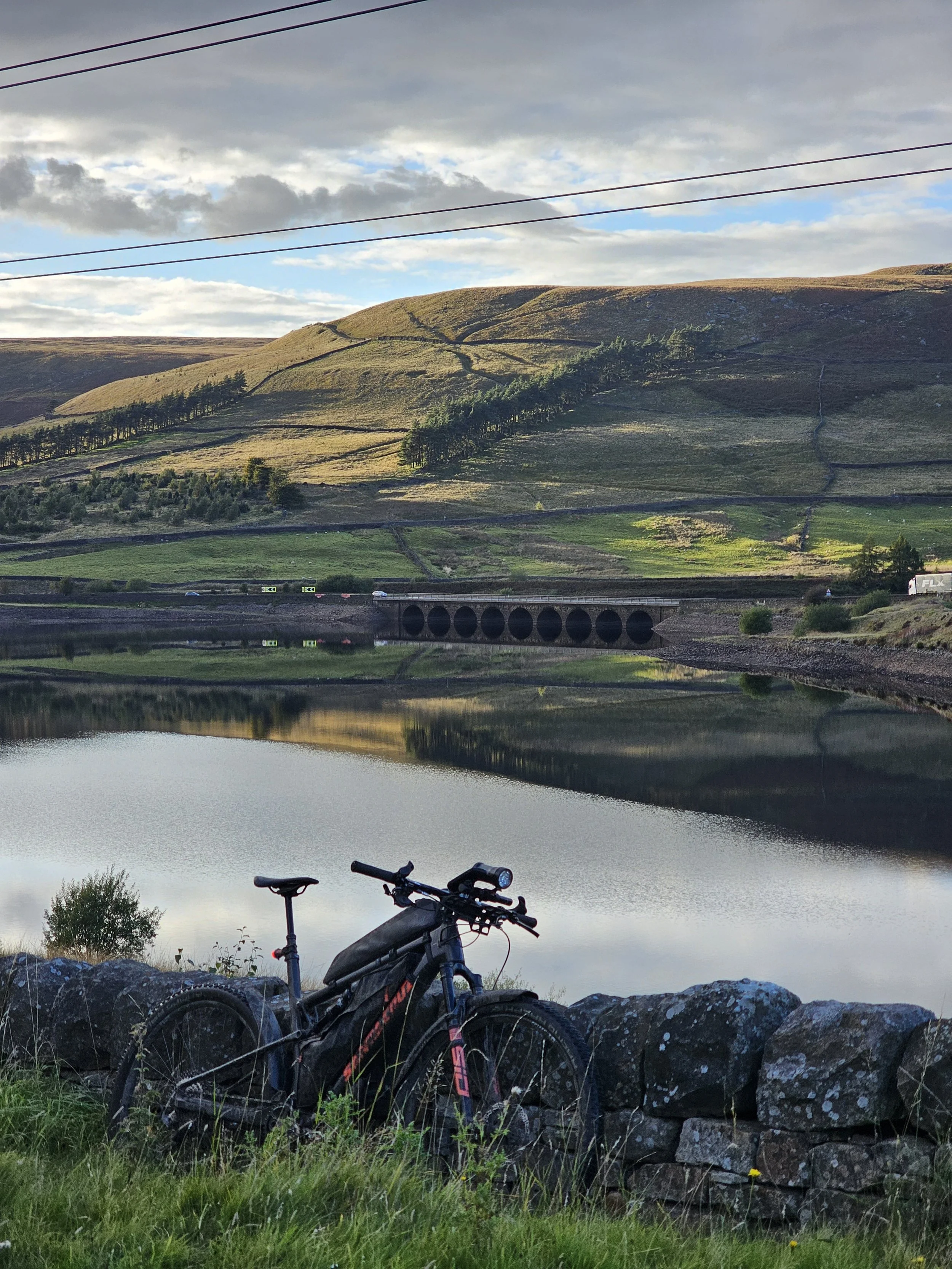
The route begins near the Dark Peak, with its rugged gritstone uplands and expansive peat moorland. Heading north-east, you'll weave through winding bridleways and peaceful trails, climbing steadily into the uplands. Early highlights include the serene reservoirs of the Upper Derwent Valley, where you'll cross challenging high moorland paths that demand both technical skill and endurance.
From here, the route takes you toward Langsett Reservoir. Although it may look close on the map, the challenging terrain will test your stamina. Be prepared to walk and push your bike, regardless of your bike choice! Beyond Langsett, a mix of forestry tracks and rocky trails leads you to Digley Reservoir. The technical climbs and descents of the surrounding moors keep you engaged before delivering you into the historic village of Marsden. Take a breather here to refuel and admire the grand Yorkshire mills before tackling the next segment.
Leaving Marsden, the route connects with trails that wind through a picturesque valley and leads you to Hayfield, a gateway to the High Peak and home to rocky paths and technical sections that MTB riders will relish. Expect challenging climbs, exhilarating descents, and stunning views over the surrounding peaks.
As the route transitions south into the White Peak, the landscape shifts to rolling green hills, limestone cliffs, and lush valleys. Villages like Tideswell and Castleton offer opportunities to pause and explore. Riding along scenic paths that follow repurposed railway lines, you’ll enjoy tunnels, viaducts, and sweeping views over the countryside and reaching the southernmost boundary of the National Park.
You'll ride through the moors and woods near Chatsworth Park - another great place to stop and recharge - before taking on some of the iconic gritstone edges that offer dramatic views over the valleys below. These sections feature some of the smoothest and most rewarding gravel trails, with just enough technicality to keep you engaged. As you near the end, the singletrack sections will challenge your legs and skills one last time before the finish line awaits.
Riding the Divide, you will reach the northern and southern boundaries of the National Park, as well as enjoy views over the cities of Manchester and Sheffield, all on one epic weekend of riding.
The Divide is an unforgettable journey combining technical challenges, scenic highlights, and the rich history of the Peak District. Whether you love rocky trails or fast and flowy tracks, this route offers something for every off-road enthusiast.

Some thoughts about the route:
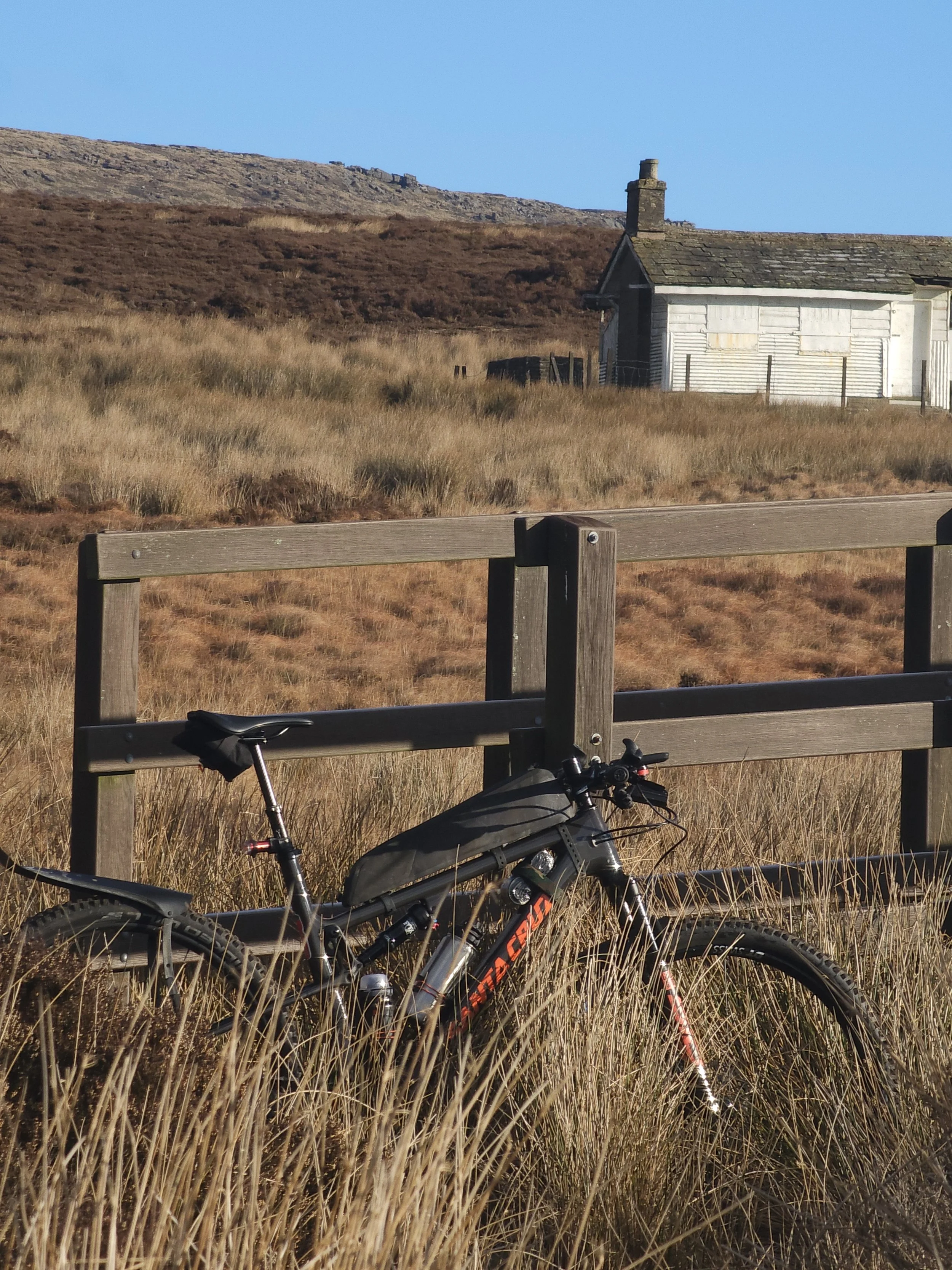
While most of the route has been ridden on a rigid gravel bike - and riders have successfully completed it on gravel bikes - we highly recommend using a hardtail mountain bike for the Divide.
Conquering the northern, first half of the route, is in our opinion the main challenge of the route. That’s where mountain biking skills (and a front suspension) will come in handy. Depending on the weather, you might want some knobbly tyres, but in normal conditions wide fast rolling tyres is all you will need. In this part of the route a MTB will be an advantage, especially when descending. Gravel riders might want to consider using 650b wheels or, depending on their skills and “resilience” opt for as wide tyres as possible. Remember, it's perfectly okay to walk: it’s a wonderful opportunity to soak in the stunning scenery and catch your breath.
The southern part of the route is where a gravel bike will shine, allowing you to get your head down and crunch the miles if that’s your thing (be mindful of other users though!). Just don’t forget you’ll be fatigued at that point so prioritise a comfy set up over a fast one.
The gentle, rolling limestone countryside will help you make good progress, and reward you for your efforts on the first day!
Depending on your fitness and confidence on the bike, you should expect to spend plenty of time on and off the saddle.
Ensure you're well-prepared, and don't hesitate to reach out with any questions: we're here to support your adventure every step of the way!
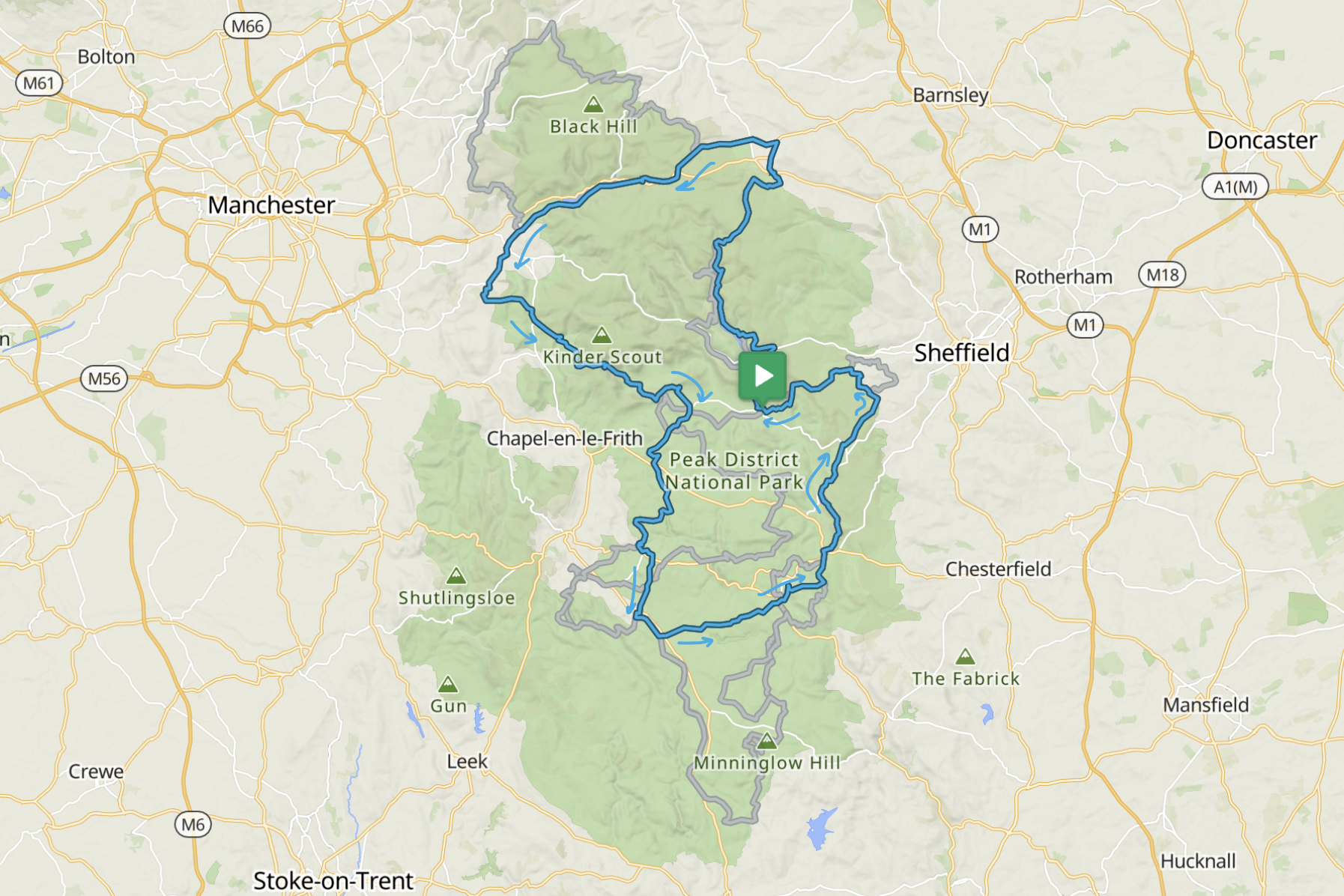
The Millstone
Approximately 155km & 3500m+ / 108miles & 11150ft+
45% paved, 55% unpaved
The Millstone route is an unforgettable journey through the Peak District, combining challenging climbs, thrilling descents, and iconic landmarks. Designed for experienced mountain bikers, it offers a mix of technical trails, rewarding views, and varied terrain that will keep you engaged from start to finish.
Starting in the Dark Peak, the ride begins with flowing trails and bridleways, leading you past the reservoirs of the Upper Derwent Valley. The imposing Derwent dam stands as a testament to the region's history and provides a scenic backdrop as you climb into the uplands. The first significant waypoint is Langsett Reservoir, where the adventure picks up pace. Be prepared to walk and push your bike to get there! A long and flowy downhill awaits you and will make you forget the climb.
From Langsett, the route joins the Transpennine Trail, guiding you through forests, open moorland, and gravel paths as you make your way toward Glossop. This section is a rider’s dream, with a balance of smooth gravel and technical challenges. Glossop’s charming streets and cafes offer a perfect opportunity to refuel before the next leg.
Leaving Charlesworth, the terrain begins to climb steeply toward Kinder Scout, gateway landmarks to the High Peak. Here, the trails become more rugged, with rocky paths and steep gradients that demand focus and determination. The reward? The exhilarating Jacobs Ladder descent and spectacular views of Kinder Scout and the surrounding moorlands.
As you continue, the route takes you over the legendary Mam Tor, also known as the “Shivering Mountain.” This section is a highlight for every rider, with its sweeping views across the Edale Valley and the remains of the old road that once connected Sheffield and Manchester. The crumbling tarmac adds a unique and atmospheric touch as your tires crunch over its surface.
The adventure doesn't stop there. As you descend into the White Peak, the landscape changes dramatically. The rugged gritstone of the Dark Peak gives way to rolling green hills, limestone cliffs, and lush valleys. A repurposed railway line, with its iconic tunnels and viaducts, will take you to Bakewell on a smooth trail giving you a break from the rocky and bumpy trails.
Villages like Castleton and Bakewell are on route, offering a chance to pause and soak in the charm of the area.
The final leg takes you along the dramatic gritstone edges of Stanage and Curbar. These iconic trails combine technical challenges with stunning panoramic views, ensuring the route ends on a high note. The champagne gravel of the White Peak carries you toward the finish, leaving you with a sense of accomplishment and the memories of an epic ride.
Riding the Millstone, you will reach the northern and southern boundaries of the National Park, as well as enjoy views over the cities of Manchester and Sheffield, all on one epic weekend of riding.
The Millstone route is a true adventure, packed with technical challenges, breathtaking scenery, and iconic landmarks. From the rocky trails of Mam Tor to the smooth paths of repurposed railway lines, this ride offers something for every mountain biker to savour.


Some thoughts about the route:
While most of the route has been ridden on a rigid gravel bike - and riders have successfully completed it on gravel bikes - we highly recommend using a hardtail mountain bike for the Millstone.
Conquering the northern, first half of the route, is in our opinion the main challenge of the route. That’s where mountain biking skills (and a front suspension) will come in handy. Depending on the weather, you might want some knobbly tyres, but in normal conditions wide fast rolling tyres is all you will need. In this part of the route a MTB will be an advantage, especially when descending. Gravel riders might want to consider using 650b wheels or, depending on their skills and “resilience” opt for as wide tyres as possible. In any case fear not, walking is 100% permitted and a great way to slow down and admire the landscape.
The southern part of the route is where a gravel bike will be ideal, allowing you to get your head down and crunch the miles if that’s your thing (be mindful of other users though!). The gentle, rolling limestone countryside will help you making good progress, and reward you for your efforts on the first day!
Depending on your fitness and confidence on the bike, you should expect to spend plenty of time on and off the saddle.
Ensure you're well-prepared, and don't hesitate to reach out with any questions: we're here to support your adventure every step of the way!
Peak Gravel
Approximately 200km & 4000m+ / 125miles & 15,000ft.
50% paved, 50% unpaved
Are you ready for an epic adventure exploring the best trails the Peak District has to offer? Our Peak Gravel route is packed with challenging climbs, thrilling descents, and stunning views that will keep you buzzing from start to finish. Whether you’re here for the adventure, the scenery, or just to test yourself, this route has it all. Get ready to ride!
The Peak Gravel route is an epic ride through the stunning landscapes of the Peak District. It’s perfect for those who love variety, with a mix of gravel paths, rocky trails, and quiet country lanes. Along the way, you’ll climb tough hills, zoom down thrilling descents, and take in some incredible views.
Starting in Bamford, the route starts with a loop along the edge of Ladybower Reservoir. The smooth gravel trails here are great for warming up, with the peaceful water and forested hills setting the scene.
Your first challenge is the climb up Stanedge Pole. It’s a steep and long climb but when you reach the top, the views over the Hope Valley make it all worth it. From here, you’ll roll across open moorland on rugged trails that really show off the wild beauty of the Peak District. The trails here are a mix of rocky bridleways and faster, smoother tracks, with stunning views as you go.
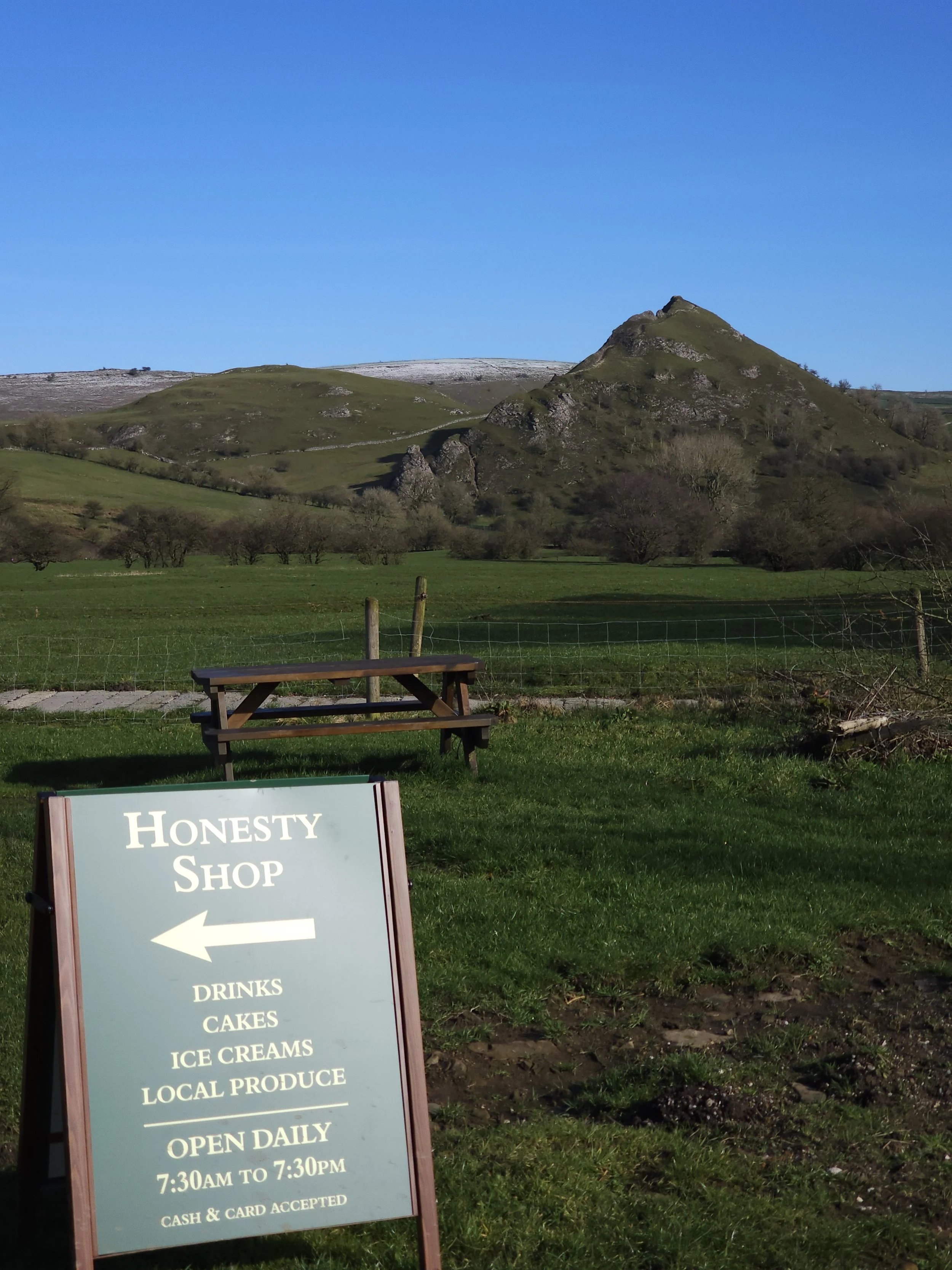
You’ll then drop down into Baslow. It’s the perfect spot for a break but if you are happy to hit one more climb, Bakewell - home of the traditional Bakewell Tart - is only a few miles away.
The route continues through the rolling hills of the White Peak, where the landscape transforms into limestone valleys and green fields. You’ll ride south towards Minninglow - an early Neolithic burial site - and its distinctive double ring of beech trees that make it a landmark for many miles around.
Once in Tissington, you’ll hop on and off the Tissington Trail, eventually reaching Parsley Hay, a key waypoint on the High Peak Trail. Here, you’ll find smooth gravel paths on the repurposed railway line, offering a chance to cruise and enjoy the views. Parsley Hay is also a great spot to stop for a breather or refuel before continuing your adventure.
The final stretch brings you back north through quiet lanes, more champagne gravel and repurposed railway lines. There are still some steep climbs to conquer though. Mam Tor, the “Shivering Mountain” should be in sight by now, with its famous Broken Road which used to link Manchester and Sheffield before being reclaimed by nature and abandoned after multiple failed attempts to repair it.
After riding through the idillic village of Castleton you’ll roll back into Bamford feeling tired but buzzing from an awesome ride.
This is not just a ride, it’s an adventure you’ll remember. From the rocky gritstone trails to the flowing gravel paths, every kilometre is packed with something special. So, grab your bike and get ready to take on the Gravel Route: the Peak District is waiting for you!

Some thoughts about the route:
There will be gravel. Plenty of it. It might not be the gravel you are used to. There also will be plenty of paved (>50% sections), so this is not really a route for a full suspension bike.
This is a route that will not require next-level mountain biking skills, but do not underestimate it! The route will take you to some of the best views the Natural Park has to offer, but the steep climbs, loose surfaces and generally hilly course will wear you down.
The recommended bike for the route is a gravel bike. A rigid MTB or hardtail with fast tyres would also work well. All the route recc’ing has been done on a rigid gravel bike with 40mm Schwalbe G-One Allround tyres. Low gears are recommended for the steep climbs. There is the odd short section where you might have to push your bike, or walk some of the steep climbs depending on gearing, fatigue, and bike weight.
Ensure you're well-prepared, and don't hesitate to reach out with any questions. We're here to support your adventure every step of the way!