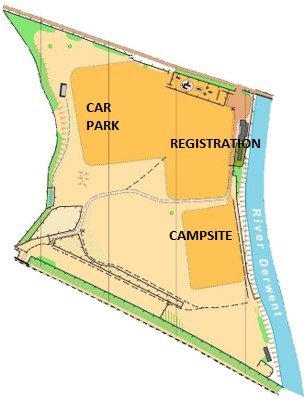
Event Location
The start and finish of the routes will be at the Event HQ. For 2025, we’ll host the event from the Bamford with Thornhill Recreation Ground.
Nested in the Hope Valley, Bamford is the ideal place to explore the Peak District. For the event we’ll use the Recreation Ground, which has a pavilion building, toilet and shower facilities, ample space for camping and parking. From the event village you can easily reach Lady Bower reservoir where the famous Dam Busters trained. It is a short ride to the lovely peak villages of Hathersage, Hope and Castleton.
The event venue, including parking and camping, will open in the late afternoon on Friday 16th May and close on Sunday 18th May at 6pm.
Camping and parking will be available to Tor Divide participants, subject to availability.
Postcode: S33 0DA, off Station Road.
What3Words ///bravo.connector.bandwagon
The Divide
Approximately 250km & 5000m+ / 155miles & 16500ft+
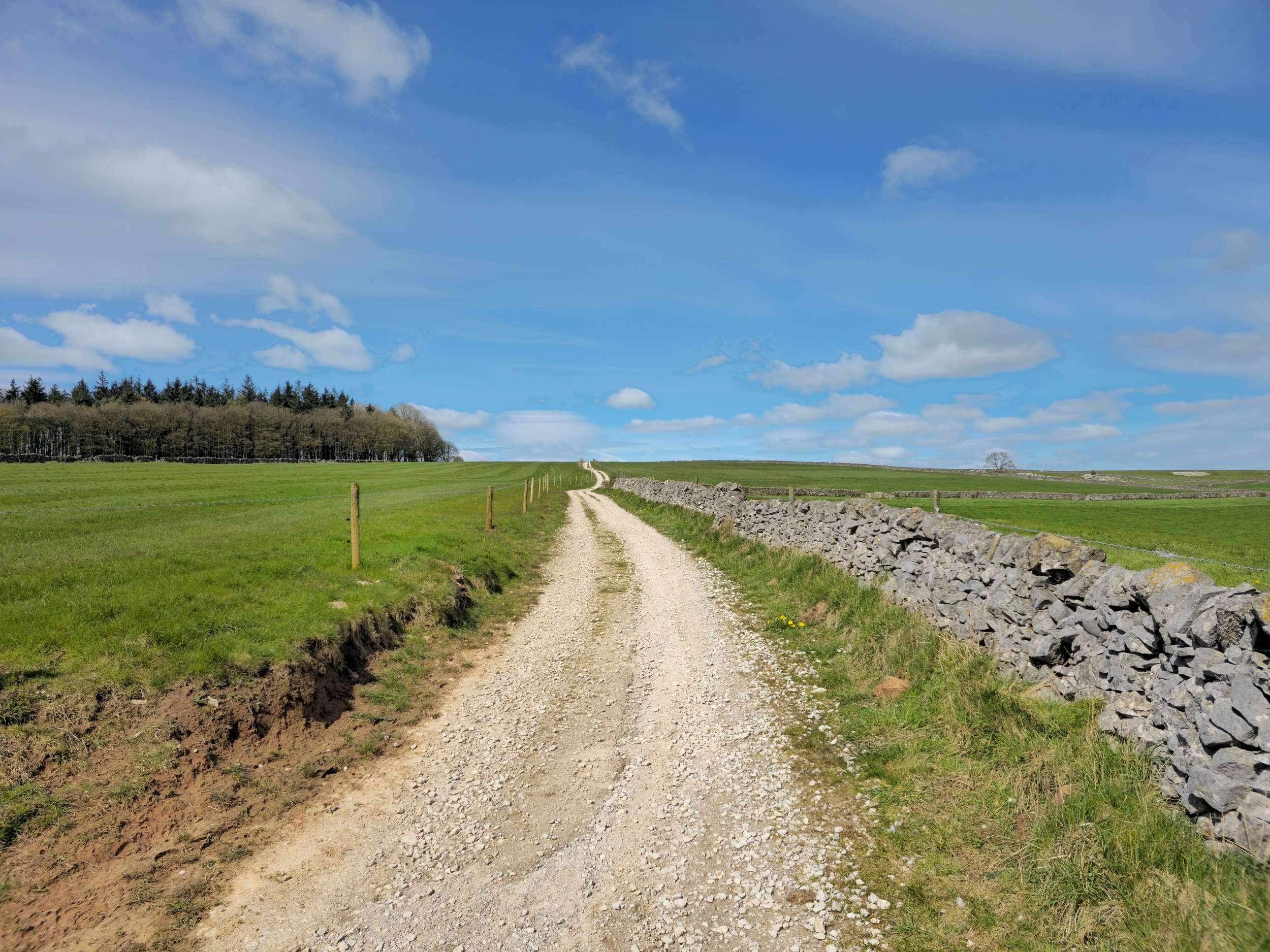
The original route. The real deal. Starting in the heart of the Peak District, the Divide will take you to the northernmost part of the National Park and have you crossing its entire length riding south on a mix of bridleways, trails and quiet lanes. By the time you reach the finish line you will have observed the landscape and terrain changing around you multiple times.
Not for the fainthearted, this route will take you on a fantastic journey across the National Park.
Detailed description coming soon.

The Millstone
Approximately 150km & 3500m+ / 105miles & 11150ft+
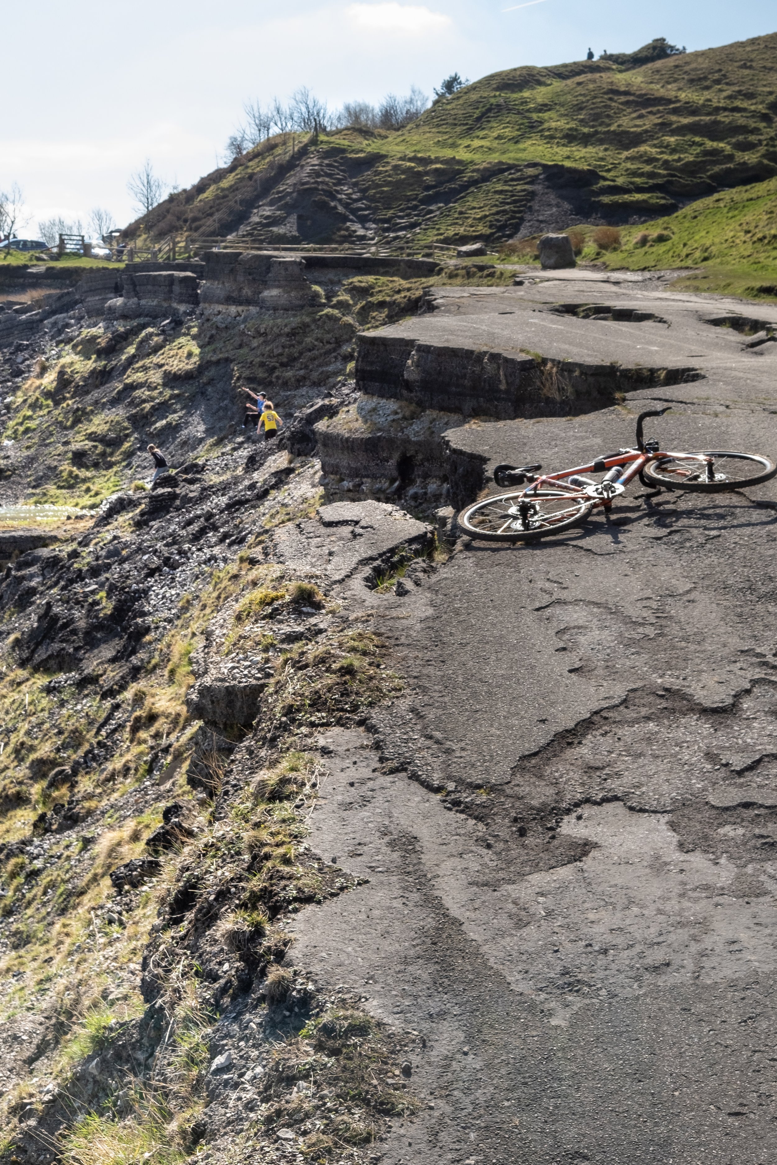
This route features some fantastic re-developed railway lines, testament to the Peak District importance during the Industrial Revolution. At that time the Peak District was criss-crossed by railway lines, in operation until the 20th century, until they were closed leaving a legacy of railway track beds.
Starting in the heart of the Peak District, the Millstone will see you reaching the northernmost part of the National Park and crossing its entire length riding into the gentle hills of the White Peak. By the time you reach the finish line you will have observed the landscape and terrain changing around you multiple times.
Detailed description coming soon.


Some thoughts about the route:
Conquering the northern, first half of the route, is in our opinion the main challenge of the route. That’s where mountain biking skills (and a front suspension) will come in handy. Depending on the weather, you might want some knobbly tyres, but in normal conditions wide fast rolling tyres is all you will need. In this part of the route a MTB will be an advantage, especially when descending. Gravel riders might want to consider using 650b wheels or, depending on their skills and “resilience” opt for as wide tyres as possible. In any case fear not, walking is 100% permitted and a great way to slow down and admire the landscape.
The southern part of the route is where a gravel bike will be ideal, allowing you to get your head down and crunch the miles if that’s your thing (be mindful of other users though!). The gentle, rolling limestone countryside will help you making good progress, and reward you for your efforts on the first day!
Depending on your fitness and confidence on the bike, you should expect to spend plenty of time on and off the saddle.
Prepare accordingly.
Peak Gravel
Approximately 225km & 4500m+
There will be gravel. Plenty of it. It might not be the gravel you are used to.
This is a route that will not require next-level mountain biking skills, but do not underestimate it! The gradients, loose surface and hilly course will wear you down, while taking you along some of the best landscapes the Natural Park has to offer.
The recommended bike for the route is a gravel bike. All the route recc’ing has been done on 40mm Schwalbe G-One Allround tyres mounted on a rigid gravel bike with 50-34 chainrings and 11-36cassette. Wider gearing is recommended when carrying bags.
Detailed description coming soon.